RIVERFRONT@DETROIT
// STATUS: competition / PROGRAM: waterfront park / PLACE: Detroit USA / PROMOTER: City of Detroit / PERIOD: 2013 /
Waterfront – views. A public space by waterfront should be impregnated of water, should be dominated by water, by access to water. An exclusive and limited space as waterfront can be lengthened by multiplying the visual access to water. Make it more accessible, not only in linear version along the river but much more complex way. The question is how to create as much access, both physical and visual access, to water as possible, from multiple points and places in the whole area. How to maximize contact with water, how to vary these contacts, how to create complex system with simple means, with accumulation of simple means. To create one system that evolves into many systems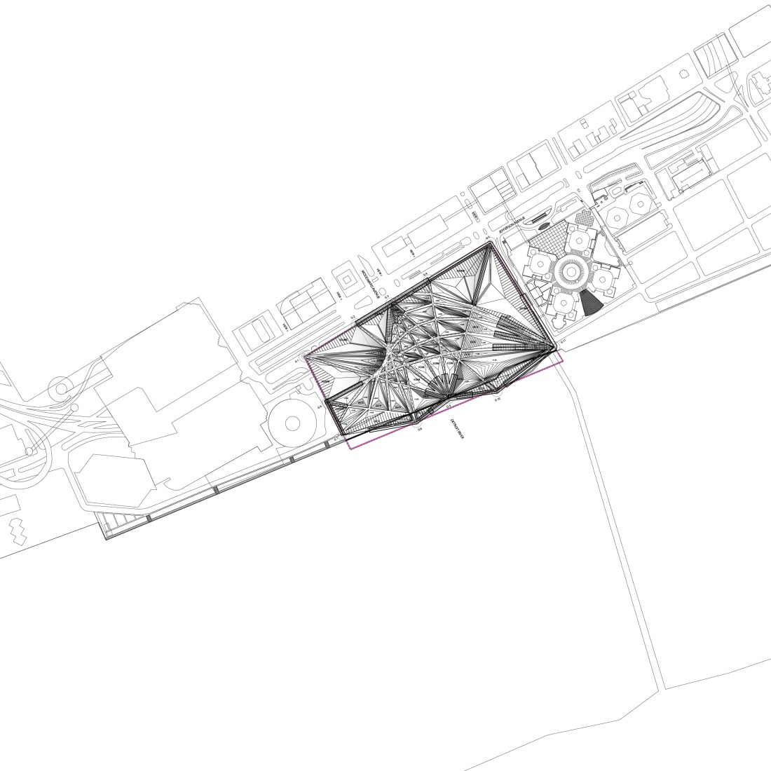
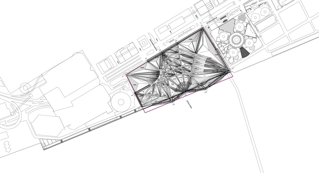
System of paths and slopes. For Detroit waterfront a system of paths is created. System of paths leads to system of surfaces in-between that leads to system of slopes which leads to system of views. Leads to longer waterfront and bigger park surface area, less exclusive and more public. System of slopes and paths > System of views and motion > System of scenes and water > System of public and performance >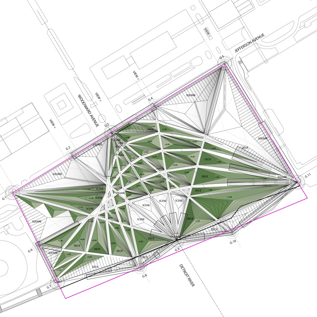
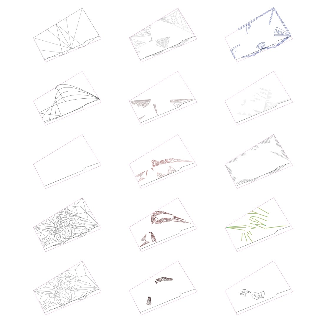
siteplan: scenes, decks, squares, ponds and slopes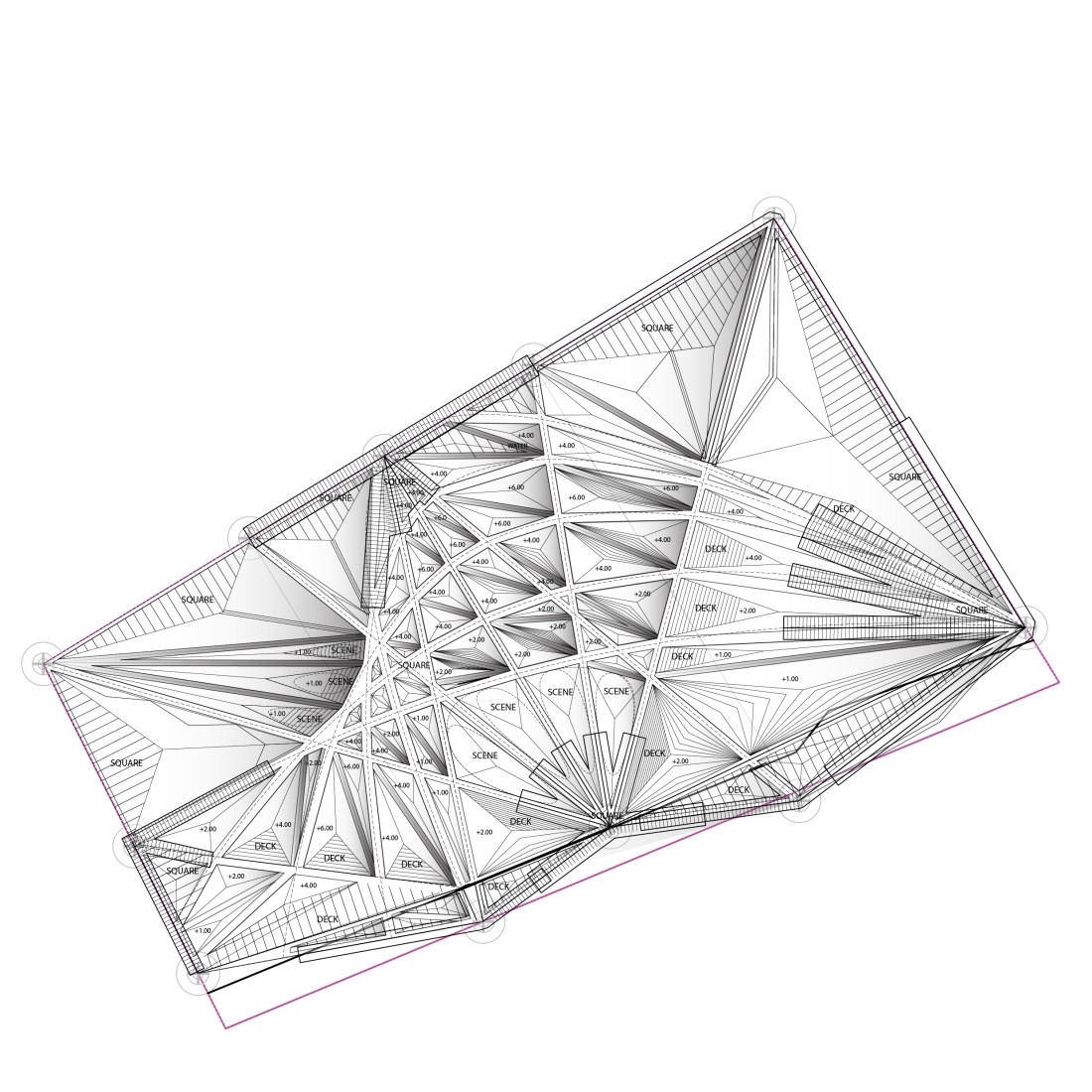 PATHS – longitudinal and transversal, different paths and lengths decide different exposure to park, different stage of penetration into the landscape of park
SLOPES – provide views or seating, vary from wild dune to wooden decks, slope = use
VIEWS – there is not one view, but many views, at almost any coordinate – view of water
RIDGE – the highest slopes form a barrier between the noise of the city and waterside
DUNES – to introduce a wild and unpredictable element in the city
SCENES – the slopes of 0 degree are used as scenes for public, concerts, performances
365 – introduction of water into the park serves in summer as in winter, all year round
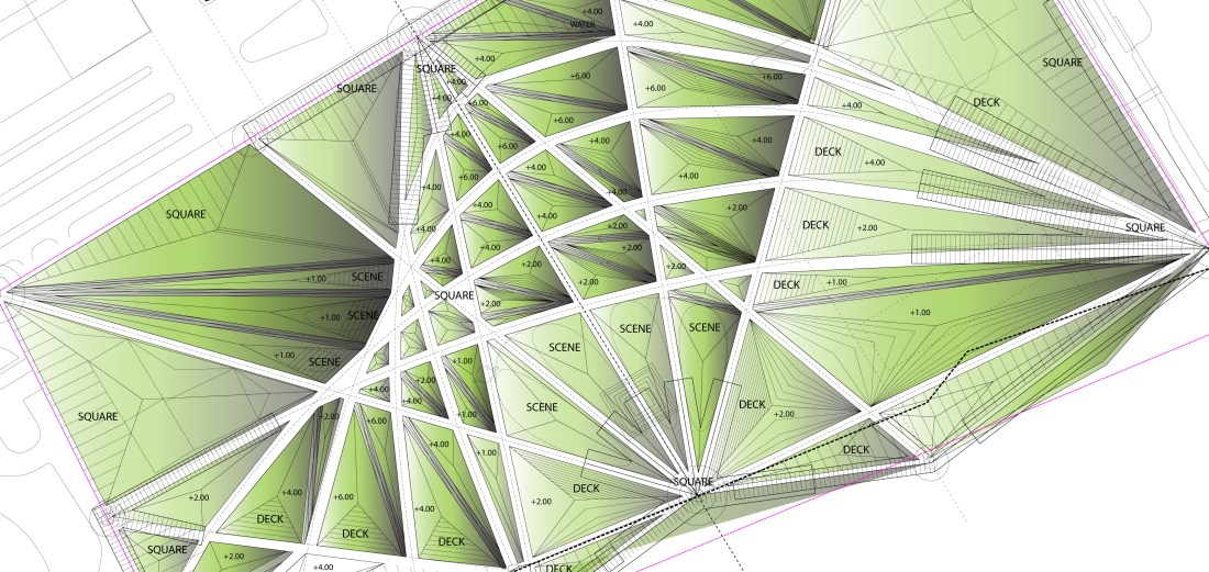 The complex surface that is created uses triangulation as method of creating same forms in both big scale and small scale, the park should be read together as one whole and has endless variety and versions locally. The different zones are created, dense or open, high slopes of dunes or lazy fields of grass, views interrupted or views from every top of slope, water in form of fountains or in ponds. The movement of people can be shortest possible and practical or long and curvy and winding path across the slopes. It can be enjoyed alone, jogging, or many, at concert. The slopes can be used as audience seats (high slope) or scenes (low slope). With created terrain the experience of water is multiplied, more complex. RESULT: Waterfront is longer, the Park bigger, the Views more (the surface thanks to slopes with each three sides is bigger).
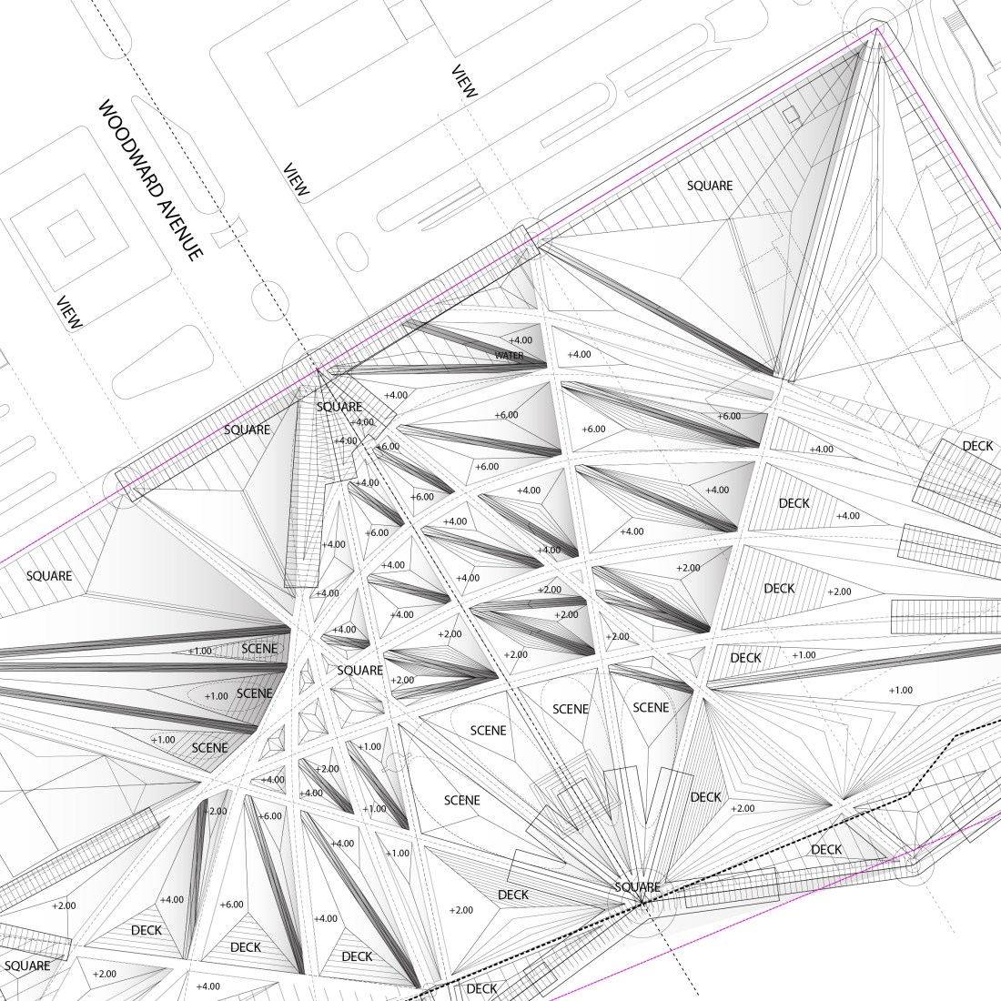
layout principle (eroded city grid by the river by the river):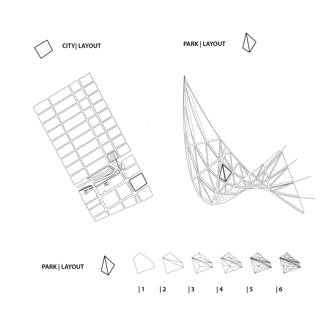
variations of use according to variations of height or constellation:
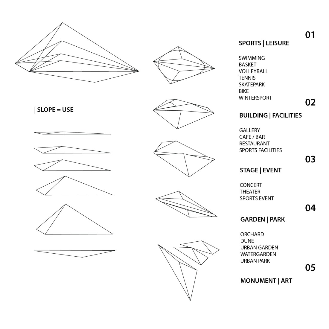 chart of materials (hard and soft surface, water, sand) and function (connections, views, squares, slopes, games)